

Winter Storm Watch Issued for the Capital Region
 Bruno from Pixabay
Terry O'Donnell
Thursday, January 4th, 2024 3:45pm
The rumors have been swirling all week, along with snowfall predictions ranging from 2 to 24 inches. The exact pattern of the storm moving up the Atlantic coast is still being closely monitored, but with each passing day it looks like we may get our first significant snowfall for the Capital Region.
On Thursday afternoon the National Weather Service issued a Winter Storm Watch for the Capital Region, the Hudson Valley, the Mohawk Valley and the Catskills. An expected 5-10 inches are possible when the snow begins falling Saturday afternoon and early evening. The snow will likely be heaviest overnight into Sunday. Complicating the matter, wind gusts could get up to 35 mph, causing visibility problems for drivers.

As with any storm, patterns can change so B 95.5 will keep you up to date on the latest. Since this would be the first (and certainly not last) significant storm of the season, be prepared with your shovel, snow brush, scraper, and be sure to top off your windshield wiper fluid.
Severe weather resources for power outages, traffic alerts and travel information, visit our severe weather page.
Latest Posts
-

-

-
-
 Social Media Influencing: A Career Now Recognized by Colleges
Daily Stories
Could this become a degree?
-
 Good News Stories for Monday December 9th
Good News
Obesity is on the decline, the first new asthma treatment in decades and seaweed powered vehicles!
-
 TikTok Asks Court To Delay U.S. Ban
Daily Stories
The app may not be accessible in the U.S. January 19
What's Happening
-
 California Wildfires
Click Here to Support the Red Cross!
-
 Your Home Sold Guaranteed Radio
The Your Home Sold Guaranteed Radio Show where you get advice you can trust from the capital region’s leading experts in real estate and all related fields.
-
 Come Work with Us
We're hiring!
-
 Madison Wealth Managers
Join Madison Wealth Managers for the ‘Planning for Prosperity Show’ Saturday mornings from 10am-11am on Magic 590 & 100.5.
-
 Herzog Law Firm
Listen Saturday mornings from 8am-830am for The Estate and Medicaid Planning Hour with Herzog Law Firm.
Events
-
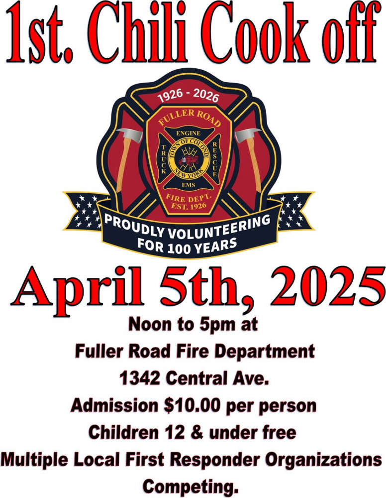 Fuller Road Fire Department Chili Cookoff
Join us for the 1st ever Chili Cookoff Fundraiser at The Fuller Road Fire Department, 1342 Central Avenue in Colonie on Saturday, April 5, from 12 p.m. - 5 p.m!...
at Fuller Road Fire Department -
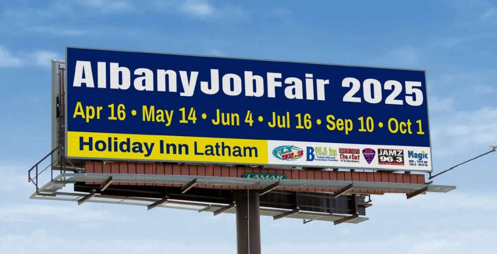 Albany Job Fair
Join us for the Albany Job Fair from 2p-6p on April 16, May 14, June 4, July 16, Sept 10, and Oct 1 at the Holiday Inn Express & Conference Center in Latham New...
at Holiday Inn Express (Crystal Room) -
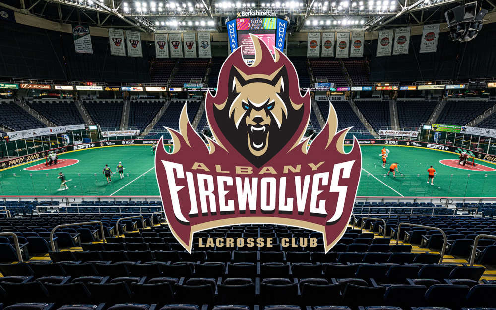 Albany FireWolves
The Albany FireWolves season is in full swing and don't miss their amazing Saturday theme nights throughout the season! Wear your maroon and come cheer on the A...
at MVP Arena